Short and Spectacular!
Wonderful short treks with stunning views for winter and summer season!
Get inspired by our short treks below and combine them with a cultural tour of your choosing. Enjoy the best of Bhutan!
Length: 3 days
Altitude: 2.900m (Dur) – 3.870m (Kitiphu) – 2.818m (Gyatsa, Chumey)
Best season: March, April, May, June and September, October, November, 1st half of December
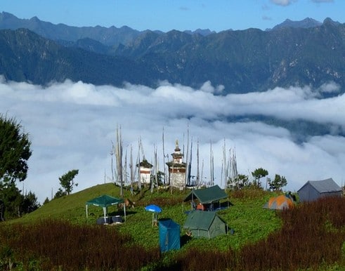
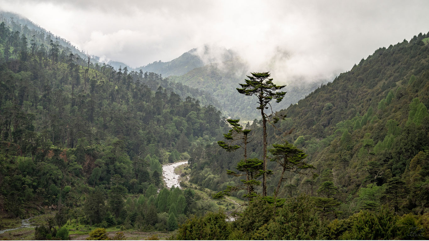
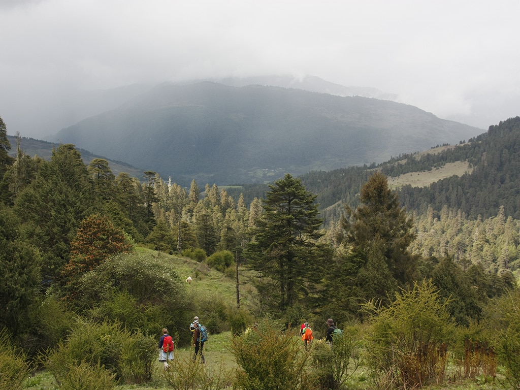
The Bumthang Owl Trek is a moderate 3-day hiking route that starts from Menchugang and ends in Jakar Dzong. The trail has an abundance of flora and fauna and offers panoramic views of the valleys beneath, the hill tops and the Himalayas.
Day 1 Manchugang – Dhur
Start at Manchugang and visit Dhur, the largest village in Bumthang, at an elevation of 2900 meters above sea level. The people in Dhur speak two different dialects, the usual Bumthang Kha and the Brokke (nomadic dialects). Climb down to the river where the traditional water-driven flour mill can be visited. It used to be a source of livelihood for the people of Dhur village. It was abandoned after the intake channel had been washed away by a flash flood. However, the watermill has been revived again as it symbolizes an authentic Bhutanese tradition. Continue the trek uphill through the blue pine forest and reach the camp at Schonath (3,450m) in hemlock and juniper forest. The hauling of owls through the night is quite common, hence the name the Owl Trek.
Camp at Schonath (3.450m), approx. 4-5 hs
Day 2 Dhur – Drangela Pass
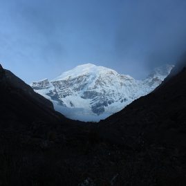
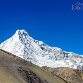
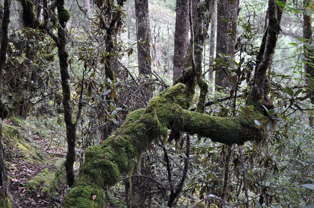
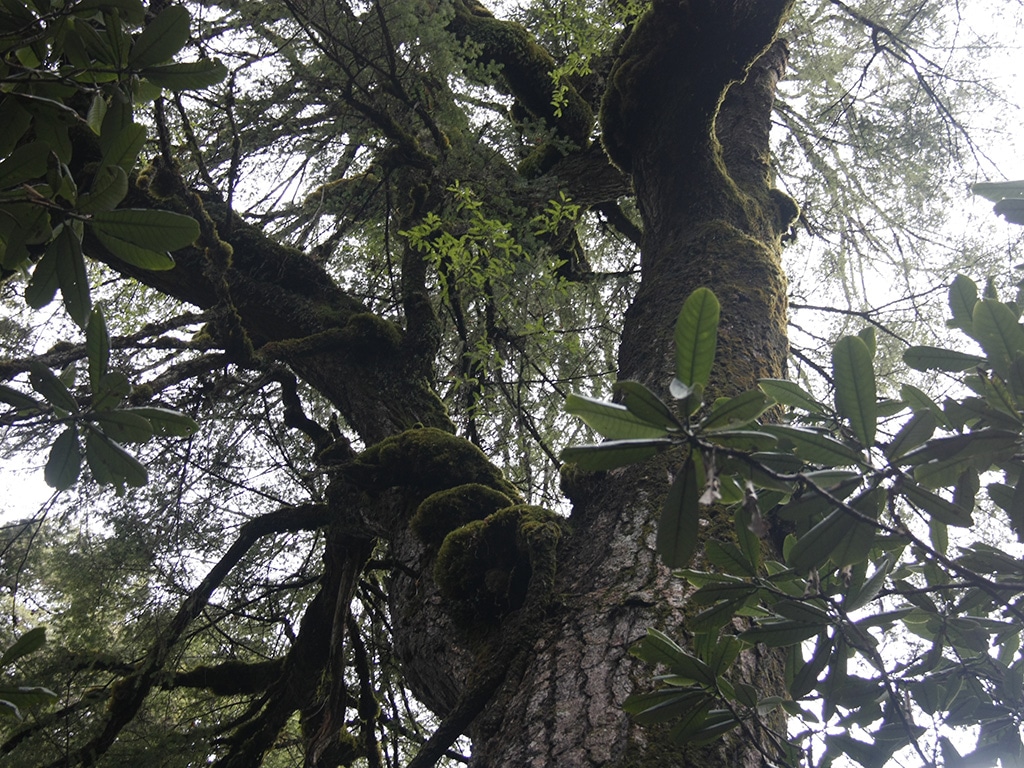
Trekking through the virgin forest of huge temperate trees like spruce, hemlock, fir, birch and many species of rhododendron makes you breathe the real wilderness of Bhutan. Bamboos are the main undergrowth of this wild forest. During the months of April and May the rhododendrons are in full bloom. In about two hours, you will arrive at Drangela Pass (3,600m). Ascend Kitiphu ridge and reach an altitude of 3,870m for the night camp. In good weather you will have a wonderful view of the valley and the panoramic snow caped Himalayan Mountains. The highest mountain of Bhutan Gangkarpunsum (7,541m) stands right in front of you when you are on the peak of Kitiphu (4,000m).
Camp at Kitiphu (3.870masl), approx. 4-5 hs
Day 3 Drangela – Tharpaling monastery
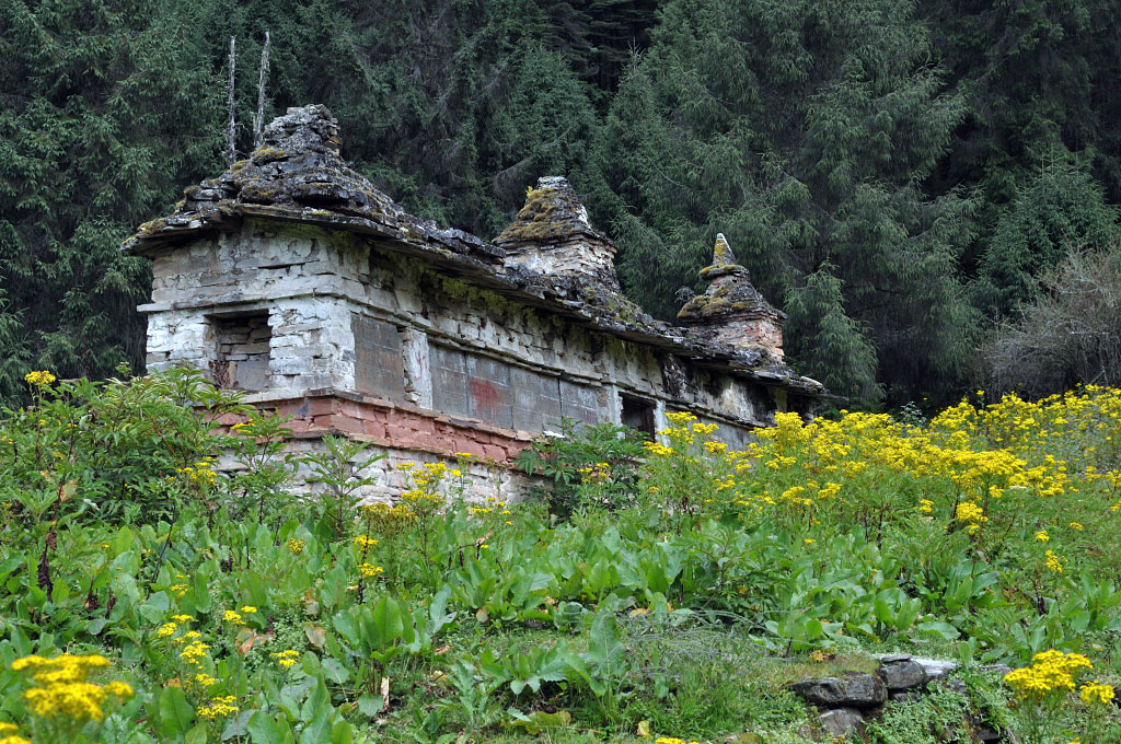
The magnificent sun rise in the morning is a new experience in Bhutan. Climb down to the monasteries of Zambhalha, Choedrak and Tharpaling which brings you to the religious life of monkhood, the historical Buddhist learning centre. Choedrak monastery has 100 Avoloketeshvaras in the form of Chukchizhey (eleven heads) that you will see nowhere else in the country. Afternoon, walk along the ridge of Kikila and finally follow the traditional trek route between Trongsa and Bumthang (the Royal Heritage Trail). The best view of Jakar Dzong will end your three day trek with many interesting and unforgettable memories. You can also conclude this trek in Chumey!
approx. 4-5 hs
Highlights:
- Village life in Dhur and encountering Brokpa und Kehp people
- Virgin forests and stunning nature
- Rhododendron Blooming in spring along the route!
- Views of Gangkar Punsum, the hightest mountain of Bhutan
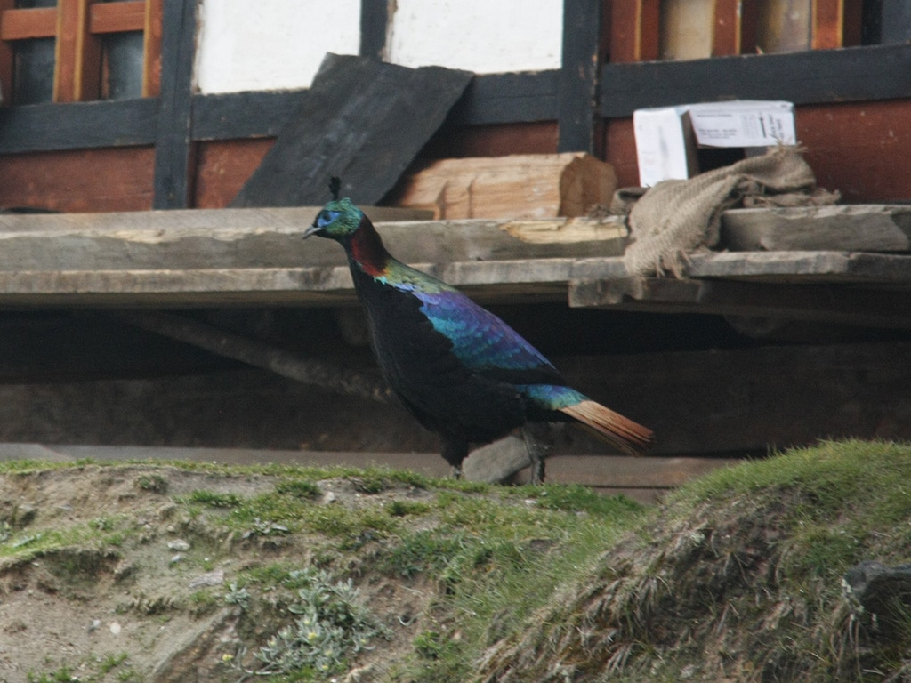
- A variety of birds, such as Monal pheasant
- Monastic life in Tharpaling and Choedak
Length: 3 days
Altitude: 2.400masl (Thimphu) – 3.180masl (Sinchula Pass) – 1.242masl (Punakha Dzong)
Best season: Year-round except July, August (Monsoon) and January (cold, snowfall)
Day 1 Thimphu – Chimina – Balakayba
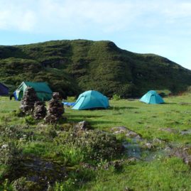
Drive to the village of Chamina, where you will meet your trekking team. Ascent to the village Balakayba through pines, oak, and rhododendron forest. After reaching the camp, you can enjoy a clear view of the village of Begana and the two monasteries Tango and Cheri.
Camp at Balakayba (2.800m), approx. 2-3hs
Day 2 Balakayba – Sinchula – Dupshepang
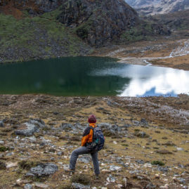
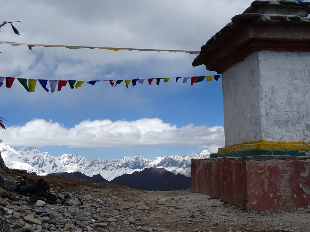
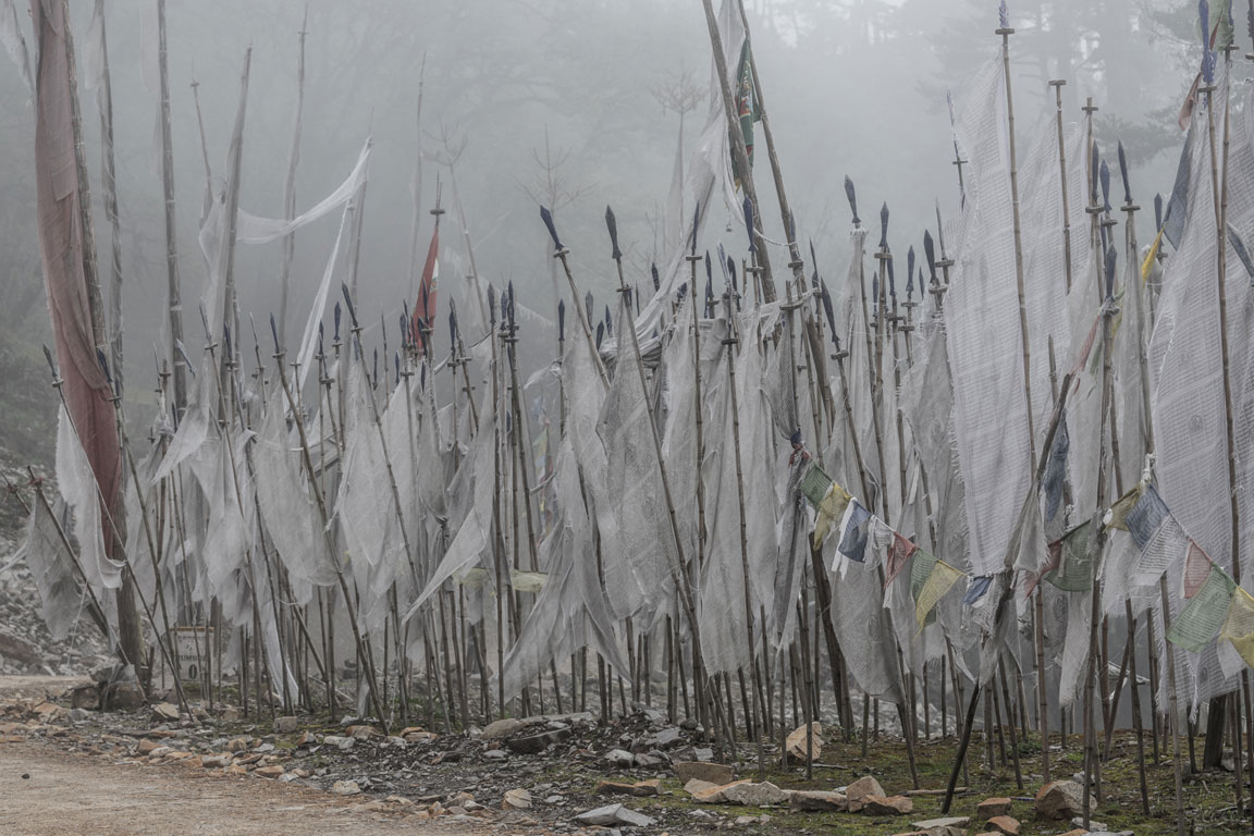
In the morning, in clear weather, you will be greeted by the Himalayan snow peaks on the horizon. Short but moderate ascent to Sinchula (la = pass) at about 3.180m. An old chorten adorns the ridge with prayer flags blowing in the wind. Hike along the ridge to Dupshepang. On a clear day you can see the monastery Phajoding, monastery Talo and the Himalayan mountains.
Camp at Dupshepang (2,440m), approx. 7 hours
Day 3 Dupshepang – Chorten Nyingpo – Sirigang / Drive to Punakha
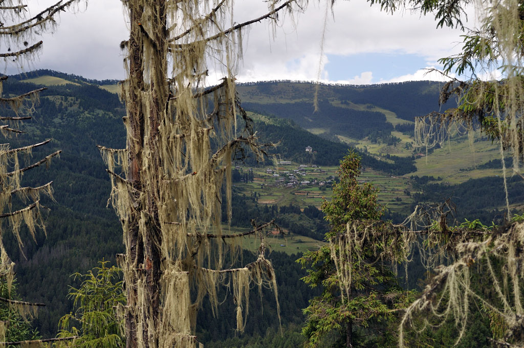
A long day lies ahead of you. The path descends for the first 4 hours through dense forests, covered with orchids, moss and lichens. Cross a few simple suspension bridges until you reach a wide beautiful valley with traditional farmhouses, terraced rice fields and small chalets. The trek ends in the village of Sirigang. Drive to Punakha stopping at the beautiful Khamsum Yuelley Chorten. From here you can enjoy impressive views of Punakaha Dzong.
Approx. 4-6 hours
Highlights:
- Wonderful scenic trek in lower altitude
- Rich flora and fauna
- Great wintertrek (Dezember to February unless there is a lot of snow) and from April to end of May (rhododendron blooming), also autumn (great views)
- Great views of the Himalayan peaks
- Connects Thimphu valley with Punakha valley, can be done both ways!
Length: 2 days
Altitude: 2.818m (Gyatsa, Chumey) – 4.000m (Tunglela Pass) – approx. 1.828m (Trongsa)
Best Season: March, April, May, June and September, October, November
This 2-day trek requires a pioneering spirit. It follows a traditional mule track between Chumey and Trongsa. The path are might not be well maintained and sometimes overgrown with bushes. Nevertheless, this short trek is a gem and offers breathtaking views of Jomolhari, Gangkar Punsum, distant mountain passes and valleys. It leads through changing vegetation and crosses the Alpine pass Tunglela until it takes you downhill all the way to tropical Samcholing in Trongsa.
Day 1 Chumey – Pamchen Pang
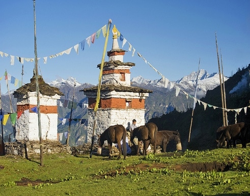
The trek starts at Gyatsa village in the Chumey valley. Start early morning and walk through magnificent pine, spruce and rhododendron forests. Once you reach Pang Zhende (3,716m), you will catch wonderful views of Gangkar Punsum, Jomolhari and Tsheringmagang. After a lunch picnic and a relaxing break, hike up to Tunglela at 4.000m. The summit is decorated with chorten and prayer flags. Descend to the camp.
Camp Pamchen Pang (3.667m), approx. 4-5 hours
Day 2 Pamchen Pang – Kuenga Rabten / Drive to Trongsa
Today the path descends downhill and the vegetation changes. The footpath meanders through dwarf-bamboo, the favorite food of yaks, until it ends at the monastery Samcholing at 1.828m. On the way to Trongsa stop at the Winter Palace of Kuenga Rabten, which the 2nd King Jigme Wangchuk built around 1929. The former private rooms can be visited.
Approx. 4-5 hours, travel time approx. 1 hour
Highlights:
- Hidden 2-day trek with a crossing of Tunglela pass (4.000m) with fantastic views!
- Avoid drive from Chumey toTrongsa on often bad roads
- Visit the winter palace of Kuenga Rabten
- Diverse Flora & Fauna all along the route
Length: 3 days (with possible extension of 3 days to Dongla Trek möglich)
Altitude: 2.897m (Orgyen Choling) – 4.160m (Rudungla) – ca. 1.500m (Lhuentse)
Best season: April until beginning of June and September to November
The 3-day Rudungla Trek is notoriously known for it’s causing problems with snow blocks and land slides near the pass in monsoon season and winter. However, it is a great experience in clear and dry weather.
Rudungla trek starts in Tang valley / Bumthang and leads through Alpine vegetation and yak pastures to an altitude of almost 4.000m. From the pass, you descend into Lhuentse valley with wonderful views along the way. The route follows the old barter trail between Tang and Lhuentse where villagers from Bumthang used to embark on seasonal migrations to Lhuentse in order to barter, trade, beg and glean. The trek can also start in Jakar / Chokhor valley at Nanglhakhang following a pleasant trail to Tang where you can spend the night in a homestay. Add a day or two to explore this beautiful valley before continuing with Rudungla Trek.
Day 1 Ogyen Choling – Phokpey
The trek starts near Orgyen Choling Palace. Through meadows and forests of pines, spruces and bamboo bushes you will ascend to a yak pasture. If you are lucky, the yak herder will be there and invite you to his hut for a cup of tea.
Camp at Phokpey (3,680), 17km, ascent 920m, approx. 5-6 hours
Day 2 Phokpey – Pemi
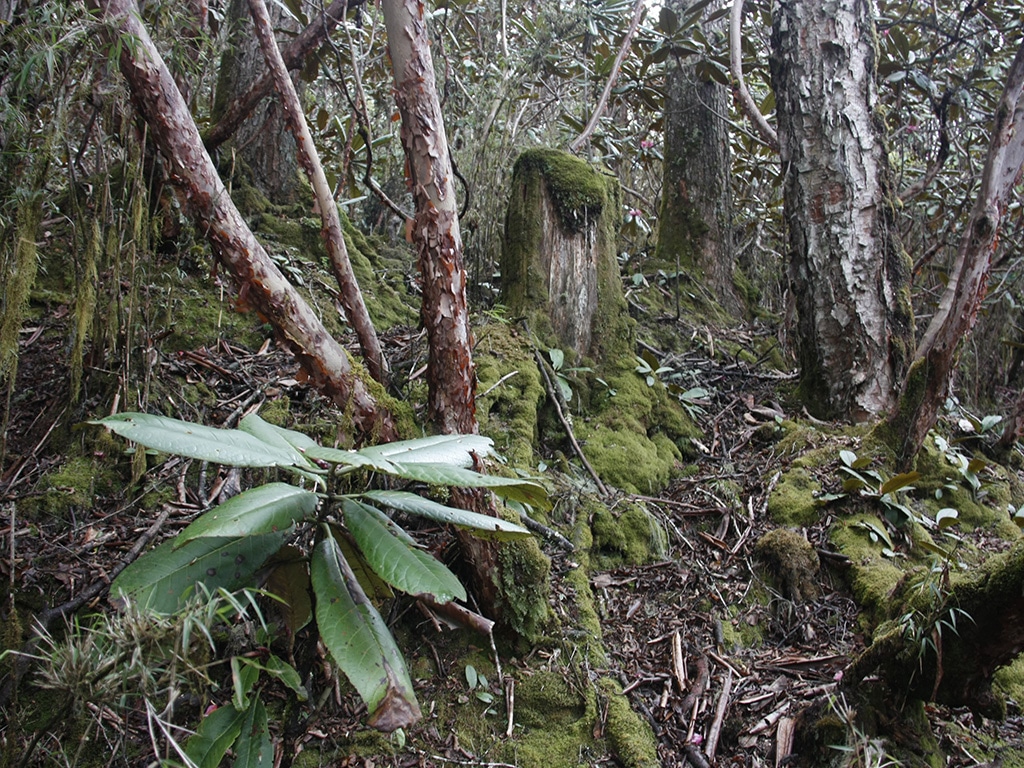
In the morning the trail continues up to Rudungla pass (4.160m). A saying goes that Rudungla is the “pass of equality”. Whether king or servant, everyone has to pass on foot. The path is steep and initially leads through lichen-hung fairy tale forest. Descend from the pass and enjoy the mystic atmosphere in misty weather. The region is shrouded in legend with tales of yetis, local deities and evil spirits. The view from Pemi is breathtaking!
Camp at Pemi (2.950m), 20km, ascent 480m, descent 1.160m, approx. 6-7 hours
Day 3 Pemi – Ungaar/Lhuentse
Long hiking day downhill to the village of Ungaar (1.500m), accompanied by wonderful views. Continue by car to your accommodation. On the way stop at Khaine lhakhang, one of the oldest temples in the country built in the 7th century by Tibetan King Songtsen Gampo to subdue a demon.
21km, ascent 350m, descent 1,340m, approx. 6-7 hours
NOTE:This trek can be extended to Trashiyangtse with the 3-day Dongla Trek. During and after the monsoon, however, this trekking route is impassable. The walking time is considerable, as you have to trek long hours due to the lack of waterholes for camp sites in between. This route is therefore recommended for flexible hikers who can walk long hours persistently with good stamina.
Extension to Dongla Trek:
Day 1 Menji – Pemi (Lhuentse)
20 km, walking distance 7 hs
Day 2 Pemi – Taupang
21 km, walking distance 7- 8 hs
Day 2 Taupang – Trashiyangtse
24 km, walking distance 8-9 hs
Highlights:
- 3-day trek with spectacular views at Rudungla pass
- Avoid the long drive from Tang to Lhuentse and enjoy serene beauty and wilderness!
Length: 3 days
Altitude: 2.670m (Haa Tal) – 4.350m (Chele La/Paro)
Best season: Mid-March to Mid-June and September to November
Sagala Trek is also called the ‘Haa Planters’ trail because in ancient times the rice planters of Haa used to travel along this path to Paro to help the people there to plant and harvest rice.
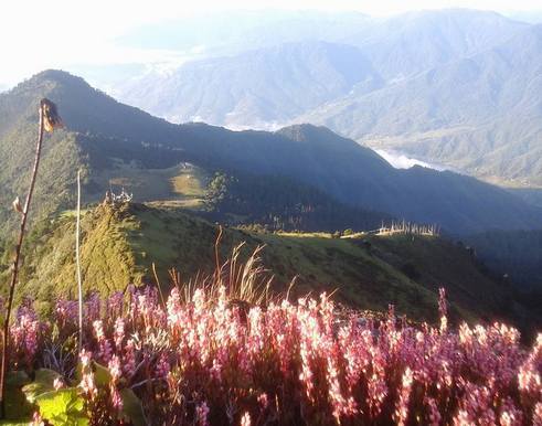
Haa valley is not much visited by tourists, and particularly Sagala trek is a beautiful 3-day hike on a mountain trail dividing Haa and Paro valleys. Traverse through beautiful meadows and virgin forests rich in flora and fauna and enjoy the wilderness in all its various shades and at its magnificent best. Soak in the panoramic and picturesque views of the Haa Valley and the three sacred hills of Haa. Walk through peaceful and quaint villages and stop at yak herders’ camps to interact with them.
One of highlights of the trek is the absolutely gorgeous view from the pass, with the Mount Jhomolhari, Mount Drageygang, Drugyal Dzong and the Taktsang Monastery on one side and Haa valley on the other.
Day 1 Haa Talung – Sagala
Your trek starts in Haa Valley (2670m), Talung village and follows an unpaved road for less than an hour on the left side of the villages. Shifting to the right side of the village, you will climb up gradually through yak herders camps until you will be met by two different trails. (The trail towards the left leads to the summer yak herding camp and to the border of China and has to be avoided). Take the right trail to make your final climb towards your camp at Sagala (3,150m).
Camp below Sagala (3.150 m), approx. 3-4 hours
Day 2 Sagala – Nyingungla
Start with a cimb of 30 minutes to Sagala pass (3550m) where you will have superb views of Mount Jumolhari (7,314m) and Jitchu Drake (6,989m) in clear weather. After several ascents and descents and walking through rhododendron bushes and meadows, you will finally reach the top of the ridge at 4100m. It offers fantastic views of Haa valley below. After some up and down through forests of hemlock and juniper, you will reach at your camp at 3850m.
Camp at Nyingungla (3.850m), approx. 5-6 hours
Day 3 Nyingungla – Chele La / Drive to Paro
Follow the path through pastureland to a yak herders’ camp. From here it leads up to Kung Karpo Sky Burial (sky burial place) at 4.350m. The road is rocky and exhausting, but the stunning view compensates the effort. From the burial ground the path continues overlooking the valleys of Haa and Paro as well as Kila Nunnery. Finally, it descends to Chele la (3-990m), where the car will already be waiting for you. Drive to Paro.
Approx. 6-7 hours
Highlights:
- Great views of Jomolhari (7.314m) and Jichu Drake (6.989m)
- Kung Karpo Sky Burial, traditional sky burial ground
- Trek connects Haa valley with Paro valley
Length: 2 days
Altitude: 3800 (Bumdrak monastery) and 4000m pass
Best season: year round except in snow (January and February)
Bumdrak trek is a little gem because it offers stunning views of the snow giants in the distance. The cherry on the cake is the GLAMP at Bumdrak camp site where you will enjoy luxury treatment for one night.
Day 1 Paro – Bumdrak monastery
The adventure begins with an early morning drive to the Sangchoekor monastery where you will meet your trekking crew; While the horses are being loaded you can visit the Buddhist college. The initial 1-2-hour ascent along a forested ridge takes you to a clearing with prayer flags and views into both the Paro and Do Chhu Valleys.
Chhoe Tse Lhakhang (temple) nestles on the mountainside further up. Climb through ruins and fluttering prayer flags passing through forest until you reach a wide meadow dotted with sacred chortens and prayer flags. Your camp is just below Bumdrak Monastery (“Cave of a Thousand Prayers”) and offers unimpeded views of the Himalayan mountain range. Visit the monastery and climb the peak to the north (about 4000 m) for even better views, returning in time for a well-earned dinner.
Approx. 4-6hs (depending on stamina)
Day 2 Bumdrak monastery – Taktsang – Paro
After a hearty breakfast, either head straight back into the valley or spend a little extra time soaking up the view. Descend into an ancient pine and rhododendron forest on the monks’ zig-zagging trail. After 1-2 hours descent you will catch glimpses of some golden roofs below. The path snakes across the mountainside between these temples before reaching the gardens of Zangto Pelri (Heaven on Earth) from where you can, if you are brave, peer over the edge, straight down onto the ornate rooftops of Taktsang monastery perched against the cliff far below. Approx. 1 hour later you will stand across the gorge from Tiger’s Nest. Follow a steep descent to a waterfall then climb some steps and you will reach Taktsang itself.
Approx. 4-6hs (depending on stamina)
Highlights:
- Great views of Jomolhari (7.314m)
- Wonderful trek for people with less time
- GLAMPING (luxury camp) near Bumdrak monastery